Showing posts with label onleash. Show all posts

Saturday, 17 May 2014

Greenmeadows Gardens at St Kilda East (my rating B)

Greenmeadows Gardens is in St Kilda East, it's a small garden with a fantastic playground.

The garden is beautiful, relaxing and peaceful, the grass is very green and comfortable.  There's no oval in the garden, thus no ball games.  But the open grassy areas are big enough for kicking a ball.

The shared path is good for scooters and in-line skates.  Drinking taps are available in the park.  The toilet is the "Exceloo", the computerized toilet.  Unfortunately the toilet wasn't in a clean state when we were there in a Saturday afternoon.

According to the sign and the Council Website, the park offers offleash area at the northern end (i.e.: Not the end where the playground is) between 6am and 9am.  Dogs must be on-leash all other times.

I was not made aware of the offleash time restriction until it was time to pack up and ready to go (when I read the sign).  However, Jessica stayed on the picnic rug all the time, so technically we didn't break the rule.  But I did see dogs run offleash, sniffing and wandering around freely, and apparently nobody made a fuss.  Looks like it's a friendly neighborhood.


Sunday, 10 November 2013

Hepburn Regional Park (my rating A)

Hepburn Regional Park is in Hepburn,  near Daylesford, about 1.5hrs drive from Melbourne City.

Most of people think about springs and SPA resorts when hearing "Hepburn" or "Daylesford", yes, Daylesford is "SPA centre of Australia", but SPA isn't the only thing Hepburn/Daylesford can offer,  Hepburn Regional Park is a big GREEN area, offering many walking tracks. (Dogs are expected to be on-leash)

 (Yes, Hepburn Regional Park features springs as well)

We parked at the Hepburn Mineral Springs Reserve, and walked to Argyle Spring and back. It took us about 2 hrs return, including rest and refreshment.  There is a bench half way to Argyle Spring, but  Mum found some 'informal' resting spots - fallen tree logs along the track.

(Sign at the car park, the car park is roomy)

(the walk we did today, map from Park Victoria website)


The walk itself was relaxing, refreshing and satisfying.  even though no heartbreaking view.  We had many chances to study the plants, and trees, and birds.  We also met Little Jonny and Miss Minne, 2 funny cute "creepy" crawlings like caterpillars.


 (Little Jonny)

(Miss Minnie)

In my opinion, the walk requires reasonable fitness, as there're numerous steps: natural ones and man-made ones.  Thanks to the walking stick, Mum managed the steps and slopes.

There're quite some spiky plants throughout the track, guess it's the way the plants protect themselves.  You might want to wear long pants and long sleeve tops to avoid the cuts.

(These plants are very popular in this park, mind your bare skin)

As the ground is very uneven, a pair of proper hiking boots would be really helpful.

(Walking Track)
When we were there, we saw quite a few trees uprooted (or fallen), and also heard the trees cracking.  It's always a good idea to have the ears wide open, for the enjoyment of birds chipping, and potential danger of the trees falling.
(Broken Tree Trunk)


(Sign on the back back to car park)


Suggest you to go to Daylesford Visitor Centre to get a copy of the map.  The staff there are very helpful and friendly.  The visitor centre is located at 98 Vincent St, Daylesford.


Sunday, 13 October 2013

Mt Beckworth Scenic Reserve@Clune (my rating A)

Mt Beckworth is located 35km north west Ballarat.  It's about 2.15hrs drive from Melbourne City via M80.

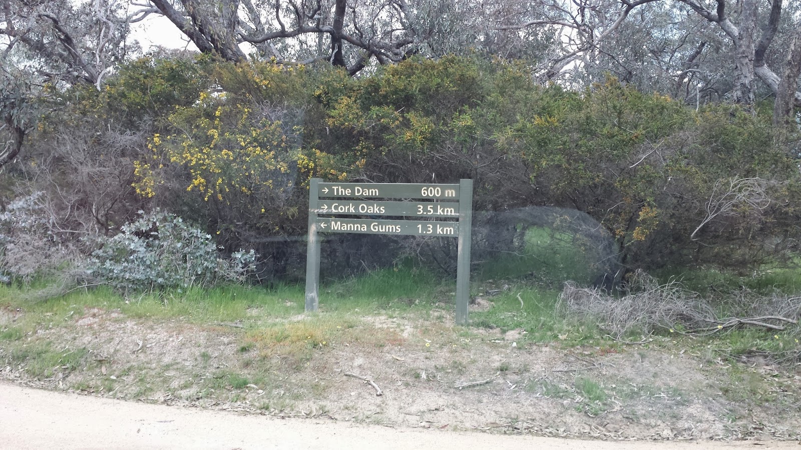
We spent some time searching for the entry.  I initially set the GPS to go from Pickfords Rd to Cork Oaks Camp Site, but for some reason, the GPS couldn't find the way.  We had to re-set the destination to the other entry (the one at the end of Mountain Creek Rd), and then followed the road within the Reserve to Cork Oaks.


(This is the Sign of "Mt Beckworth Scenic Reserve" at the Entry)

(The sign at the Entry)


There're a few signs in the park showing the way, but not sufficient in my opinion, especially when the road splits, there's no sign to tell you which way to go.  Thanks for my GPS, I had a reference (yup, to turn on to the road that looks closer to the destination).

But once we arrived, it made all the effort worth.  The Cork Oaks is a nice camp site, with toilet facilities.

After a well-prepared hotdog lunch, we set the hiking to "Mt Bechworth" summit.

As said before, there was no enough signs, we followed the sign of "Mt Bechworth" at the beginning, soon we found us climbing up the mountain following sort of walking trail.  It was literally and actually climbing, the path is really steep, and not well formed (so different from You Yangs and 1000 Steps).  Mum and Jessica climbed 2/3, then decided to go no further. 

It took us 45 mins to reach the summit, this is one of the reasons I believe we didn't follow the track (it says on the sign about 3hr return if stays on the walking track).

However, I must emphasize I made no complain at all.  The view is breathtaking, the climbing was fun! It made the hiking more adventurous, the only regret was Mum and Jessica couldn't make to the summit and enjoy the view.

My suggestion to you, if you plan to visit this reserve, please do have a hard copy of the Park Notes, and I'm sure you would thank your proper hiking boots after climbing the mountain, they would protect your ankles and also provide good grip.


(Sign at the Cork Oaks)

(This section of the climbing is easy compared to the summit part)

(View at 1/3 from the summit)


(path at the start, much steeper than what looks in this photo)

(This is the path heading summit)


(map from Park Vic website)


Saturday, 28 September 2013

RJ Hamer Arboretum@Olinda (my rating A)

RJ Hamer Arboretum is surrounded by Dandenong Ranges National Park, a wonderful place to visit.  It's just about 1 hr drive from Melbourne city.

We loved the magnificent view, the vast green and massive beautiful trees.  The kids loved to run up and down the hills.  There are 2 BBQ stoves, sheds and toilet facilities.  The toilets are reasonably clean.

Please note there's not bin at the park.  You'll need to 'Take your Rubbish Home'.  We did take our rubbish HOME, and into our own Rubbish Bin. :-)

We did a bush-walk after picnic lunch.  It took us some moments to confirm that the first part of the track is to cross the grassy plain.  See the map below, the walk we did is traced over in blue, it took us 2 hrs return.  Some part of the track is quite steep, and because it was wet, the path was quite slippery.  There is no bench along the path, but we managed to find a few tree logs / stumps for Mum to rest.
(Map downloaded from Park Victoria website)


The only problem I found was to find the path and direction.  I hope Park Victoria can make the signs clearer and better.  To me, there wasn't enough track signs.

And because of this, I would highly suggest you to have your map ready (I had a softcopy map i.e. PDF file stored on my Smart Phone, downloaded from Park Victoria Website), the track guide map at the Information Display Board is barely informative.  And you'll find wearing hiking boots help a lot.

(How would you like it to have picnic lunch facing such magnificent view?)


(This is where we started our walk)

(After 50-100m, the path is more visible)


(At the edge of of the grassy plain, there's a sign on the left). 
(The stony road is Mathias Road)


(Follow Mathias Road, past "Red Dog Hut" on the left, you'll see this sign)
(We turned left onto Sequoia Track)

(Follow Sequoia Track to the end, you'll see the T section, and the Sign)


(This kookaburra accompanied us till Red Dog Hut)
(It was low-flying ahead of us, then stopped and waited, and flew again)


Wednesday, 18 September 2013

Woodlands Historic Park@Greenvale (My rating B)

Greenvale is near Melbourne Airport, Woodlands Historic Park is a big natural park at Greenvale managed by Park Vic, boasts a homestead, several walking tracks and landscape.

Dogs are allowed on-leash in this park.


Obviously this park is popular.  We entered the park from Somerton Road on a cloudy Sunday, there, more than 10 cars had parked.  Don't worry, there're plenty of parking spots.  We parked near the Shed and Toilet Facilities.

The walk we did was 'Woodlands Hill Lookout', it is a easy 45mins return walk, suitable for toddlers and young children.  There are some rocks near the lookout, it won't surprise me to see children climbing them.


To start with, follow the sign "Gellibrand Hill", cross the bridge, walk for another 800m or so, you'll then see the sign "Woodlands Hill Lookout".
 

If you're lucky, you might be able to see some lizards sun bathing on the rocks.

At lookout, you can overlook the Melbourne Airport.

The walk 'Gellibrand Hill' takes about 4hrs return (according to informal info), I shall find another time to do it.


See pictures below, this is how easy the walk is:


We went to Sunbury for lunch and then Sunbury Recreation Reserve for the afternoon. This recreation park is on my A list.

Sunday, 1 September 2013

Playground@Maldon Visitor Centre (My rating C)

Maldon is a town near Castlemaine, about 2hrs drive from Melbourne City.  If you visit the town for a day, the playground at Maldon Visitor Centre (behind the visitor centre) is a good spot for the kids to have a chance to run and burn some enegy.  The picnic tables and benches are available, as well as the toilet facilities.

We were there on a Sunday afternoon, though the kids enjoyed the play there, I found the food 'leftovers' especially bread and donuts on the grassy ground, not sure if people deliberately left the food there for the birds, or just didn't bother to bin it.

I had to keep a close eye on Jessica my baby cavalier, as she loves food, and she takes every opportunity to vacuum the food from the ground.

(the playground behind the visitor centre@Maldon)


We went to Mt Tarrangower and Anzac Hill @Maldon.

On the way back to Melbourne, we stopped by at Western Reserve@Castlemaine, there's a skate park there, and the kids had fun on their scooters in the skate park.

Mount Tarrangower@Maldon (My rating C)

Maldon is a town in Mount Alexander  Shire Council, near Castlemaine.  It's about 2hr drive from Melbourne City.

Mt Tarrangower is within Maldon Historic Area Reserve, managed by Park Victoria.

I was hoping to hike from Maldon Town to Anzac Hill to Mount Tarrangower Lookout, but it was 1pm by the time we arrived at the Visitor Centre@Maldon, and got map of  Maldon Historic Area Reserve.

After a light lunch, it was too late to hike.  So, activated plan B, which was to drive to Mount Tarrangower Lookout, and drive to Anzac Hill (it's 4WD track between Mout Tarrangower Lookout and Anzac Hill).

Driving along the High Street, you'll see the Brown Tourist Sign "Mount Tarrangower" on your left.  Turn Left and keep going straight, you'll come to Mount Tarrangower Lookout, the road is all sealed, by the way.

(Lookout Tower at Mt Tarrangower, you can climb)

(View from Lookout Tower)

(View from Lookout Tower) 

We followed the "Fountain Track" to go to the Anzac Hill.  The track shown on the map above is "Adair Track", another 4x4 track.  To go to Fountain Track, keep driving straight from the way you come from (you'll have Adair Track on your left, and the Lookout Tower on your right), you'll then see the track (it's well labled)

(Anzac Hill)

(Map downloaded from Park Victoria)


The view was nice, but didn't make me say "wah!!!!!!!".  And I was glad I didn't do the hiking, as by judging the track, it would be a bit boring on foot.  Driving to Anzac Hill was good though.


When we were there (on the Father's Day), Maldon was quiet and peaceful.  the staff at Visitor Centre were very helpful and friendly.

We went to the playground behind the Visitor Centre after Anzac Hill.  The kids enjoyed the play there.

On the way back to Melbourne, we stopped by at the Western Reserve@Castlemaine, there's a skate park there, and the reserve is offleash.

 The visitor centre: 93 High Street Maldon