Showing posts with label hiking. Show all posts

Sunday, 13 October 2013

Mt Beckworth Scenic Reserve@Clune (my rating A)

Mt Beckworth is located 35km north west Ballarat.  It's about 2.15hrs drive from Melbourne City via M80.

We spent some time searching for the entry.  I initially set the GPS to go from Pickfords Rd to Cork Oaks Camp Site, but for some reason, the GPS couldn't find the way.  We had to re-set the destination to the other entry (the one at the end of Mountain Creek Rd), and then followed the road within the Reserve to Cork Oaks.


(This is the Sign of "Mt Beckworth Scenic Reserve" at the Entry)
(The sign at the Entry)


There're a few signs in the park showing the way, but not sufficient in my opinion, especially when the road splits, there's no sign to tell you which way to go.  Thanks for my GPS, I had a reference (yup, to turn on to the road that looks closer to the destination).

But once we arrived, it made all the effort worth.  The Cork Oaks is a nice camp site, with toilet facilities.

After a well-prepared hotdog lunch, we set the hiking to "Mt Bechworth" summit.

As said before, there was no enough signs, we followed the sign of "Mt Bechworth" at the beginning, soon we found us climbing up the mountain following sort of walking trail.  It was literally and actually climbing, the path is really steep, and not well formed (so different from You Yangs and 1000 Steps).  Mum and Jessica climbed 2/3, then decided to go no further. 

It took us 45 mins to reach the summit, this is one of the reasons I believe we didn't follow the track (it says on the sign about 3hr return if stays on the walking track).

However, I must emphasize I made no complain at all.  The view is breathtaking, the climbing was fun! It made the hiking more adventurous, the only regret was Mum and Jessica couldn't make to the summit and enjoy the view.

My suggestion to you, if you plan to visit this reserve, please do have a hard copy of the Park Notes, and I'm sure you would thank your proper hiking boots after climbing the mountain, they would protect your ankles and also provide good grip.


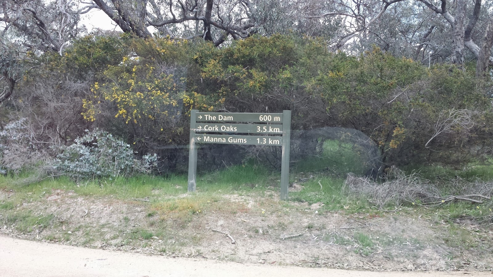
(Sign at the Cork Oaks)

(This section of the climbing is easy compared to the summit part)

(View at 1/3 from the summit)


(path at the start, much steeper than what looks in this photo)

(This is the path heading summit)


(map from Park Vic website)


Saturday, 28 September 2013

RJ Hamer Arboretum@Olinda (my rating A)

RJ Hamer Arboretum is surrounded by Dandenong Ranges National Park, a wonderful place to visit.  It's just about 1 hr drive from Melbourne city.

We loved the magnificent view, the vast green and massive beautiful trees.  The kids loved to run up and down the hills.  There are 2 BBQ stoves, sheds and toilet facilities.  The toilets are reasonably clean.

Please note there's not bin at the park.  You'll need to 'Take your Rubbish Home'.  We did take our rubbish HOME, and into our own Rubbish Bin. :-)

We did a bush-walk after picnic lunch.  It took us some moments to confirm that the first part of the track is to cross the grassy plain.  See the map below, the walk we did is traced over in blue, it took us 2 hrs return.  Some part of the track is quite steep, and because it was wet, the path was quite slippery.  There is no bench along the path, but we managed to find a few tree logs / stumps for Mum to rest.
(Map downloaded from Park Victoria website)


The only problem I found was to find the path and direction.  I hope Park Victoria can make the signs clearer and better.  To me, there wasn't enough track signs.

And because of this, I would highly suggest you to have your map ready (I had a softcopy map i.e. PDF file stored on my Smart Phone, downloaded from Park Victoria Website), the track guide map at the Information Display Board is barely informative.  And you'll find wearing hiking boots help a lot.

(How would you like it to have picnic lunch facing such magnificent view?)


(This is where we started our walk)

(After 50-100m, the path is more visible)


(At the edge of of the grassy plain, there's a sign on the left). 
(The stony road is Mathias Road)


(Follow Mathias Road, past "Red Dog Hut" on the left, you'll see this sign)
(We turned left onto Sequoia Track)

(Follow Sequoia Track to the end, you'll see the T section, and the Sign)


(This kookaburra accompanied us till Red Dog Hut)
(It was low-flying ahead of us, then stopped and waited, and flew again)


Sunday, 1 September 2013

Mount Tarrangower@Maldon (My rating C)

Maldon is a town in Mount Alexander  Shire Council, near Castlemaine.  It's about 2hr drive from Melbourne City.

Mt Tarrangower is within Maldon Historic Area Reserve, managed by Park Victoria.

I was hoping to hike from Maldon Town to Anzac Hill to Mount Tarrangower Lookout, but it was 1pm by the time we arrived at the Visitor Centre@Maldon, and got map of  Maldon Historic Area Reserve.

After a light lunch, it was too late to hike.  So, activated plan B, which was to drive to Mount Tarrangower Lookout, and drive to Anzac Hill (it's 4WD track between Mout Tarrangower Lookout and Anzac Hill).

Driving along the High Street, you'll see the Brown Tourist Sign "Mount Tarrangower" on your left.  Turn Left and keep going straight, you'll come to Mount Tarrangower Lookout, the road is all sealed, by the way.

(Lookout Tower at Mt Tarrangower, you can climb)

(View from Lookout Tower)

(View from Lookout Tower) 

We followed the "Fountain Track" to go to the Anzac Hill.  The track shown on the map above is "Adair Track", another 4x4 track.  To go to Fountain Track, keep driving straight from the way you come from (you'll have Adair Track on your left, and the Lookout Tower on your right), you'll then see the track (it's well labled)

(Anzac Hill)

(Map downloaded from Park Victoria)


The view was nice, but didn't make me say "wah!!!!!!!".  And I was glad I didn't do the hiking, as by judging the track, it would be a bit boring on foot.  Driving to Anzac Hill was good though.


When we were there (on the Father's Day), Maldon was quiet and peaceful.  the staff at Visitor Centre were very helpful and friendly.

We went to the playground behind the Visitor Centre after Anzac Hill.  The kids enjoyed the play there.

On the way back to Melbourne, we stopped by at the Western Reserve@Castlemaine, there's a skate park there, and the reserve is offleash.

 The visitor centre: 93 High Street Maldon


Tuesday, 23 July 2013

Special Post: DogParks-VIC Australia

I've just published a free Android App on Google Play called "DogParks-VIC Australia".  Feel free to download it to your Android Mobile Device if you have one.

The whole idea is to locate dog offleash (mainly) parks near you (based on GPS location).  The app can also show the entire dog offleash network,  Hope that will help you plan your adventure with your loved ones.

I'm still building up the list, consolidating the different info from local councils, visitor centres and Victoria Park.

I'm focusing on Melbourne Inner Suburbs and Other Cities in Victoria at the moment.  I guess people in rural and remote victoria areas aren't strict as long as your dog behaves.  However, I was told off (not by a civil servant, but by a tearoom lady) when we were holidaying at Silverton NSW (near broken hill).  Jessica was offleash exploring around in her graceful manner.  :-(


Anyway, hope you find the app handy.


Monday, 13 May 2013

Macedon Regional Park @ Macedon (my rating A):

Macedon Regional Park is about 1.5 hrs drive from City.

Part 1:
We parked at Harbison Picnic Ground, and did the walk to Camels Hump Car Park.  The whole walk is 4.8km.  It took us nearly 3.5 hrs to complete the trail and return.  The walk starts near the tea house.

(Map from Park Victoria)

Some sections are quite steep, loose stones are throughout the path.  Wearing walking boots would be wise.


(entrance to the trail)


(this is the sign to follow)

(This sign is at McGregors Picnic Ground)


Suggest you to get the map / Park Note from ParkVic beforehand.

Part 2:
Hello, Macedon!  Again................

This time we parked at the McGregors Picnic Ground, had lunch, and started the walk towards the Camels Hump Lookout.  I've found my favourite Picnic Ground!  It's here, at McGregors!  Quiet and Paceful and Relaxing, surrounding by the big tall trees, green grass, several picnic tables and benches.  It's not as popular as Harbison Picnic Ground, thus not as noisy as at Harbison.

(McGregors Picnic Ground)

The walk was easy, especially from Camels Hump Car Park to the Lookout, it's all paved.

(trail to Camels Hump Lookout)
 
 (to Lookout)


(Lookout)

(View from Lookout)

(View from Lookout)


The whole walk took 1 hr return, at the leisure pace.  We spent an additional hour at the Lookout!

Sunday, 3 February 2013

Kurth kiln regional park (my rating B)


Kuryh kiln regional park is just an hour or so from melbourne, it makes the park ideal if you want to escape from the city noise, stress & civilization.
We parked at the lower car park of kurth kiln pinic ground (cnr beenak & soldiers).  At the time we were there, the 2 small car parks were almost full.  There were people camping there.
We did the 'thornton walking track', it took about an hour to finish the loop.  The walk was easy to moderate, with uphills & downhills. 


It was very peaceful deep in the forest, especially though it's summer & flies were buzzing at the entry of the track, I stopped noticing any after 15mins' walk.

We drove to the waterfall afterwards, but the fall wasn't particularly spectacular.


(Shiprock Falls)

Please check the bushfire risk before going (www.cfa.vic.gov.au/)


Saturday, 29 December 2012

Kooyoora State Park (my rating A)

Kooyoora State Park is located 220KM NW of Melbourne,  it took us about 3 hrs to get there.

We went to Melville Caves, parked at Melville Caves Picnic Area.   Picnic tables, benches and toilet facilities are available there.


We did the Melville Caves Walking Track.  It took us 75mins to finish the track (loop), including 20mins admiring / resting on the summit.


Part of the track is very steep,  Mum's bushwalking stick helped her a lot!  But the view is super rewarding.

(Mum and her bushwalking stick)


There're big rocks to climb.  My kids loved it!  They both said they wanted to come back again!


Before you go, please check bushfire risk rating, have a print-out of park map (you may download it from parkvic website: http://parkweb.vic.gov.au/explore/parks/kooyoora-state-park), a pair of proper walking boots is always a good choice.


(Seal Rock, you would easily spot it out)

(Lookout@Summit)

(Lookout@Summit)